Why Hundreds of Ships Are Buried on Namibia's Skeleton Coast
Wanderline Staff
August 26, 2026 · 6 min read
“"Fog, a freezing current, and a desert that swallows evidence — the real reason Namibia's Skeleton Coast became the world's largest shipwreck graveyard."”
Somewhere along an 800-mile strip of Namibian coastline, a German cargo ship sits nearly half a kilometer from the ocean. It didn't drift there. The desert grew around it.
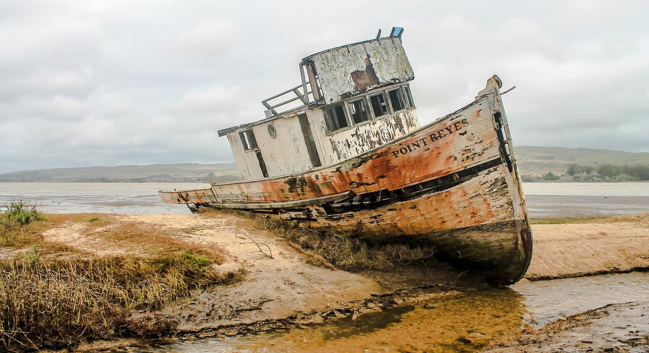
The Eduard Bohlen ran aground in 1909, and the sand has been closing in on it ever since. It's one of an estimated 500 wrecks scattered along this stretch of coast, a graveyard so consistent, so relentless, that it earned a name sailors still use as a warning: the Skeleton Coast.
The obvious question is why. Why here, specifically, out of every dangerous coastline on Earth? The answer isn't bad luck. It's a set of conditions that stack on top of each other almost perfectly to make this one stretch of ocean nearly impossible to navigate — and, for centuries, nearly impossible to survive once you'd already gone down.
The Fog Is the Real Killer
Everything starts with two temperatures colliding.
The Benguela Current runs up the west coast of southern Africa, carrying cold water north from near Antarctica. Where that cold water meets the warm, dry air rolling off the Namib Desert, the temperature difference condenses moisture straight out of the atmosphere. The result is fog — thick, frequent, and capable of rolling in with almost no warning.
For a 19th- or early 20th-century ship's captain navigating by sight and dead reckoning, that fog erased the coastline. Sandbars shift constantly in this stretch of ocean, so even charts that were accurate a year earlier could be wrong. Combine invisible sandbanks with zero visibility and a current that's actively pushing vessels toward shore, and ships didn't so much wreck as get delivered onto the beach.
This wasn't a once-in-a-generation hazard. It was a standing condition of sailing this route at all, for as long as ships used it.
The Desert Finishes What the Ocean Starts
Running aground here didn't necessarily kill you. Namibia's coast finished the job differently — by making rescue almost impossible.
The Skeleton Coast sits at the edge of the Namib, one of the driest deserts on Earth, with almost no fresh water and few landmarks for hundreds of kilometers in either direction. A sailor who survived a wreck and swam ashore hadn't reached safety. They'd reached a desert with no way to signal for help and no realistic route to civilization on foot.
That's the layer most articles on this topic skip: the wreck was rarely the fatal event. The days afterward were. Crews who made it to the beach faced a stretch of coastline so remote that walking out wasn't a rescue plan — it was often a slower version of the same fate. This is part of why local Indigenous communities gave the region a name that translates roughly to "the land God made in anger," and why Portuguese sailors reportedly called it the "gates of hell." Both names describe the same thing from different angles: this coast doesn't just wreck ships, it removes the option of walking away from the wreck.
Three Wrecks, Three Different Eras of the Same Problem
The Skeleton Coast has been claiming ships for roughly 500 years, which means the how has changed even though the why hasn't.
The oldest known wreck (1533). Discovered only in 2008, when a diamond-mining operation uncovered it near Oranjemund in southern Namibia, this Portuguese merchant vessel is believed to have been headed for the East Indies when a storm drove it into the rocks. No human remains were found with it — whether the crew escaped or were lost to the sea afterward is genuinely unknown, one of the coast's smaller unsolved questions.
The Eduard Bohlen (1909). A German cargo ship en route from Swakopmund to Cape Town, lost in thick fog and run aground at Conception Bay. It's the wreck most people picture when they hear "Skeleton Coast" — a ship's hull sitting in dry sand, hundreds of meters from any visible water, because the shoreline itself has moved on without it.
The Dunedin Star (1942). A British cargo-passenger ship carrying supplies and civilian refugees fleeing London during WWII. It struck an underwater obstruction and ran aground, triggering one of the most drawn-out rescue efforts in the region's history — ships, aircraft, and overland vehicles all struggled against the same fog, sandbanks, and desert terrain that caused the wreck in the first place. It's the clearest illustration of how the coast's danger doesn't end when the ship stops moving.
Three wrecks, four centuries apart, and the failure mode is identical each time: fog and shifting sand cause the wreck, then the desert makes everything afterward harder.
Why the Wrecks Are Still There
Most shipwrecks elsewhere get reclaimed by the sea, broken down by waves, or salvaged for parts. The Skeleton Coast does something different: it buries them.
Because the desert is actively expanding at points along this coastline, the shoreline has moved outward over the past century, leaving ships that wrecked "on the beach" now sitting deep in sand dunes, sometimes visible only as a rusted hull breaking the surface. It's why the Eduard Bohlen looks less like a shipwreck and more like an archaeological excavation in progress — because in a sense, it is one.
Visiting the Skeleton Coast Today
For travelers, the Skeleton Coast is now a protected national park, and getting there requires planning specifically because of the same conditions that made it dangerous in the first place.
Go with a licensed guide or tour operator. Self-driving here is legal in parts of the park, but the remoteness and lack of cell coverage are exactly what made the coast lethal for shipwreck survivors — the risk hasn't disappeared, it's just been reframed as a tourism logistics problem instead of a maritime one.
Expect fog in the mornings, most of the year. The same weather pattern that wrecked ships makes for eerie, atmospheric photography conditions — just build extra time into any drive.
The most accessible wrecks sit in the southern part of the park, near Walvis Bay and Swakopmund, including the Zeila and Eduard Bohlen. The Dunedin Star wreck site, further north, requires a more serious overland or fly-in expedition.
There's no fresh water source along most of the route. Carry more than you think you need — the desert's basic hazard to 20th-century sailors hasn't gone anywhere for 21st-century visitors.
Frequently Asked Questions
Why is it called the Skeleton Coast? The name is usually credited to South African writer John Henry Marsh, who documented the region's wrecks. It refers both to the ship skeletons littering the shore and to the whale and seal bones left over from the whaling industry that once operated there.
How many ships have wrecked on the Skeleton Coast? Estimates vary by source, but figures commonly cited put the number at around 300 documented wrecks, with evidence suggesting the true total — including undocumented and buried wrecks — could be closer to 500 or more.
Can you still see the shipwrecks today? Yes. Several, including the Eduard Bohlen and the Zeila, are accessible on guided tours from Walvis Bay and Swakopmund. Others remain buried or are in more remote sections of the park that require a longer expedition.
Is the Skeleton Coast dangerous for tourists now? Not in the way it was for 20th-century sailors, but the remoteness is real. Fog, poor signage, and long distances between fuel and water sources are why guided travel is strongly recommended over independent self-driving.
Did you find this story